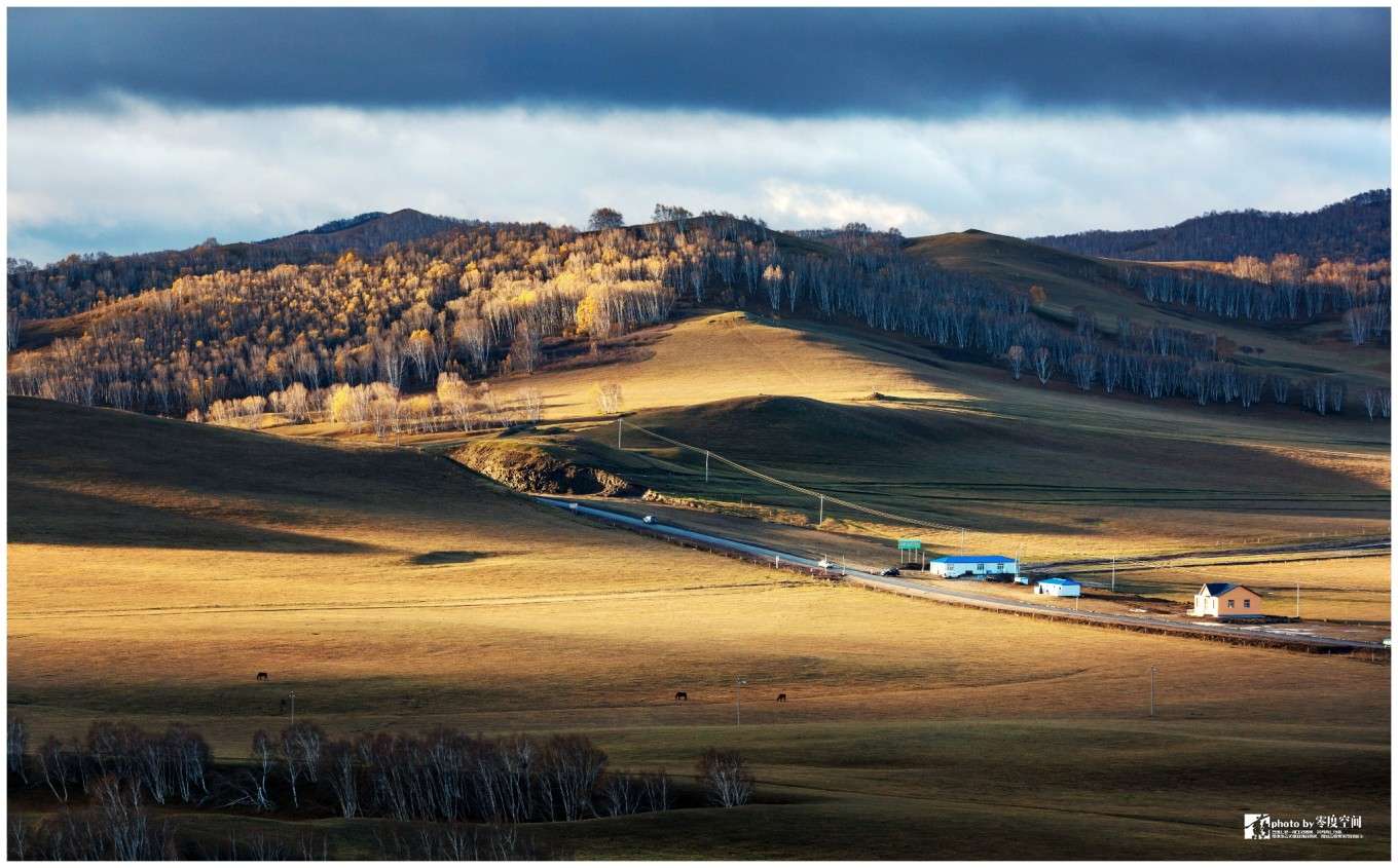
How to play the narrow Inner Mongolia depends on what you want to see. The east is grassland and forest, the west is desert, and the middle is the Gobi grassland like desert transition. Inner Mongolia is a good place to play, depending on when you go. Going to the desert in winter is a pain in the neck, and in the spring, central and western Inner Mongolia can’t escape the dust.
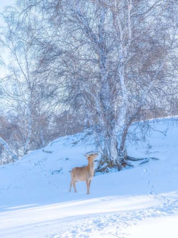
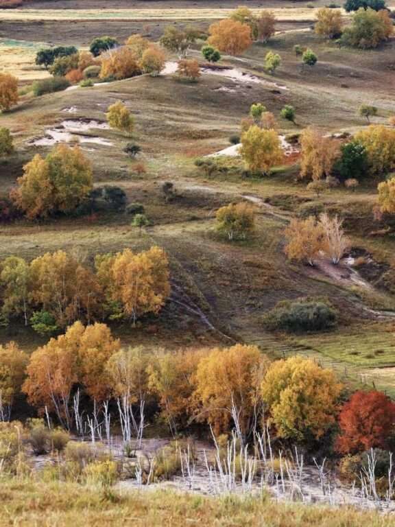
Northeast Inner Mongolia: Grasslands and forests
If you want to ride the Inner Mongolia grassland, there are plenty of options. There are many large and small grassland pastures in Inner Mongolia, but the most classic ones are the following.
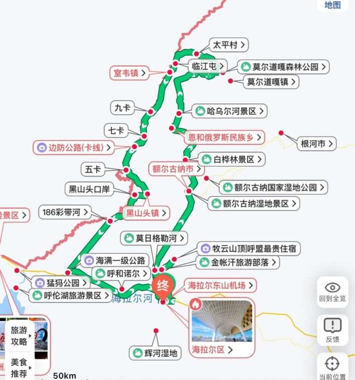
Hulunbuir Ring Line
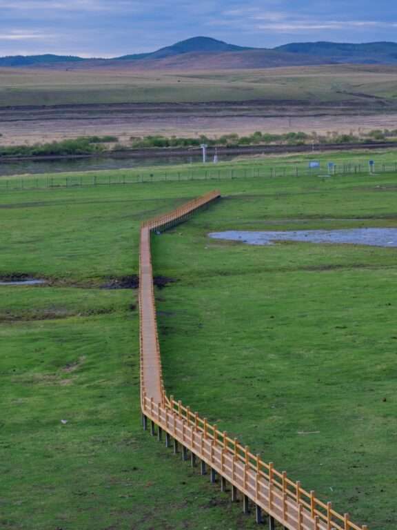
Hulunbuir Grassland can be regarded as the NO.1 grassland in Mongolia. The season when people flock to it is summer, and the straight road reaches the sky in the vast grassland. On both sides of the road are the picturesque scenery of cattle and sheep. This ring line can not only see the grassland and wetland scenery in the east, but also go along the China-Russia border, which can collect small towns with Russian style all the way.

【 Reference route 】
D1: Hailar → Mozhgrad River → Erguna Wetland → Erguna
D2: Erguna → Birch Forest → Genhe River → Aolu Guya Ethnic Township
D3: Aolu Guya Ethnic Township → Moerdaoga → Linjiang Sunset Mountain → Shiwei
D4: Shiwei → nine cards → eight cards → Taiji map → Heishan Head
D5: Heishan Head →186 Ribbon River → Manzhouli
D6: Manzhouli → Hulun Lake → Chenbaerhu Grassland → Hailar
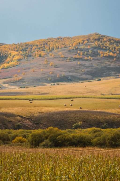
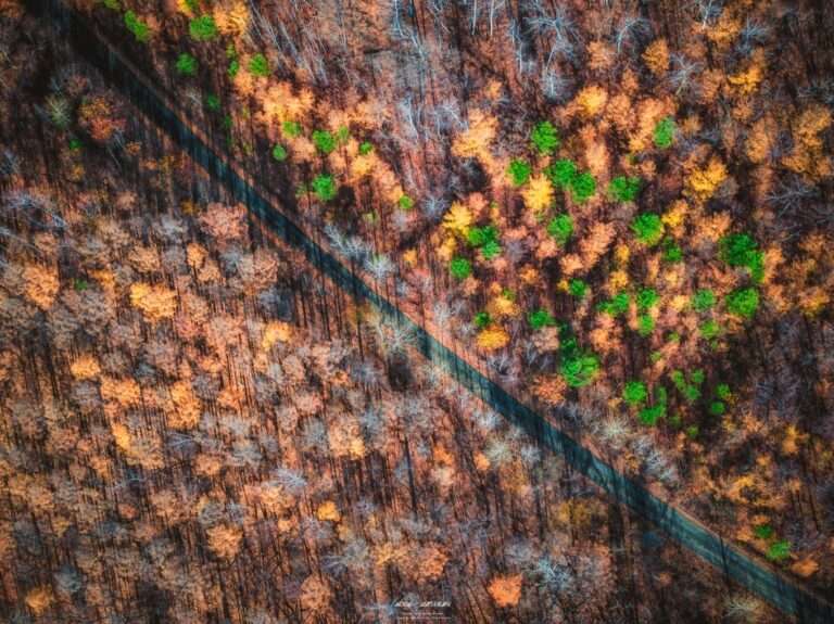
And if you come before the autumn festival, the Greater Hinggan Mountains in the east and the Arshan Mountains in the south are worth joining the trip. Hailar, as a distribution center, can contain the most important scenery in eastern Inner Mongolia. And autumn, the most beautiful season in the Greater Khingan Mountains, the golden grassland spreads to the forest sea, all the way to the sky.
The Daxing Anlin section of the ring line overlaps with Yalin Railway line, and the Moga Highway, a landscape avenue connecting Arshan and Guqi Town of Zalantun, is also included. It can not only be relatively free to clock in the railway station along the line, but also enjoy the scenery on the road without constraints.
【 Reference route 】
D1: Hailar → Manzhouli
D2: Manzhouli → Heishan Head
D3: Heishan Head → Enhe → Siwei
D4: Shiwei → Linjiangtun → Qigan
D5: Qikan → Moldoga → Golden River Town
D6: Golden River Town → Ituri River Town → Turi River Town
D7: Turi River Town → Kudur Town
D8: Kutur Town → Yakeshi
D9: Yakeshi → Boketu → Tarqi Town
D10: Taqi Town → Chaihe Town (Maoya Road)
D11: Chaihe Town → Tianchi → Yershi Town (Moga Road)
D12: Irshi → Hailar

Greater Khingan Mountains Line
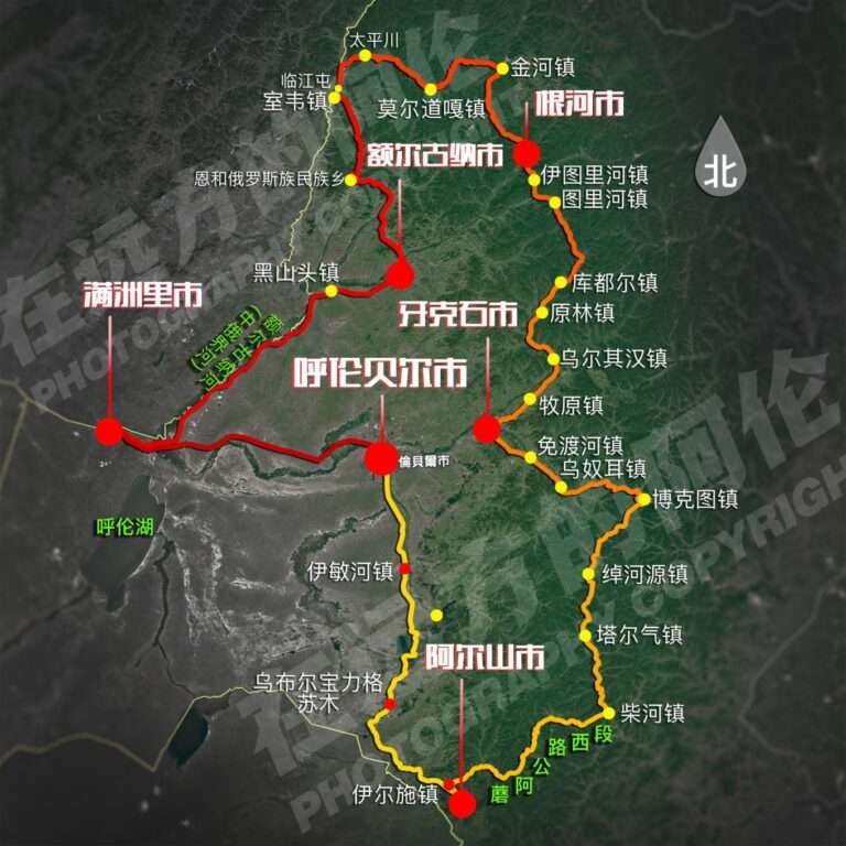
The most beautiful season in the Greater Khingan Mountains is autumn, and there are two main ways to play this forest line, one of which is inseparable from the Hulunbeer grassland and Arshan Mountain, and the whole process is in Inner Mongolia. The other line connects the Little Hinggan Mountains, enjoying the forest scenery throughout.
[Driving in the Greater Khingan Mountains and Hulunbuir Grassland]
D1: Hailar → Manzhouli
D2: Manzhouli → Heishan Head
D3: Heishan Head → Enhe → Siwei
D4: Shiwei → Linjiangtun → Qigan
D5: Qikan → Moldoga → Golden River Town
D6: Golden River Town → Ituri River Town → Turi River Town
D7: Turi River Town → Kudur Town
D8: Kutur Town → Yakeshi
D9: Yakeshi → Boketu → Tarqi Town
D10: Taqi Town → Chaihe Town (Maoya Road)
D11: Chaihe Town → Tianchi → Yershi Town (Moga Road)
D12: Irshi → Hailar
[Greater Khingan Mountains + Lesser Khingan Mountains self-driving line]
This line runs along the border between Heilongjiang and Russia, from the Greater Khingan Mountains forest area to the Lesser Khingan Mountains, while from Qiqihar to Hailar, one can follow the Middle East railway line, collecting the Middle East railway complex along the way. In autumn and winter, this route is more interesting.
D1: Hailar → Root River
D2: Root River → Mooroga → Golden River
D3: Golden River → Mangui → Mohe River
D4: Mohe → Arctic Village → The First Bay of Longjiang → Shishizhan Township (G331)
D5: Shishizhan Township → Heihe (G331)
D6: Heihe → Wudalianchi
D7: Five Dalian Pool → Qiqihar
D8: Qiqihar → Zalantun → Boketu
D9: Boktu → Hailar
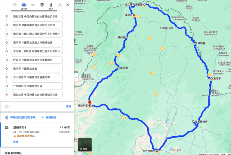
This line can also be expanded, starting from Harbin, you can check in along the Middle East railway along the railway station, take Qiqihar, Zalantun, after Zalantun take the Moga road to Arshan Forest Park. Then he went north to Manzhouli. Starting from Manzhouli, you can take the border line or the root river line. After reaching Mohe in the north, turn to the important Lindu Kagedaqi on the other side of the Greater Khingan Mountains. Jiagedaqi to the south of the five big Lianchi, Yichun, is the original forest scenery of the Little Hinggan Mountains.
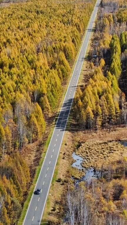

D1: Harbin City → Qiqihar → Zalantun
D2: Zalantun → Alshan National Forest Park (Moga Road)
D3: Alshan National Forest Park → Manzhouli
D4: Manzhouli → Heishan Head → Enhe → Shiwei (card line)
D5: Shiwei → Mooroga → Golden River Town
D6: Jinhe Town → Mangui → Mohe
D7: Mohe River → Birch forest in Nine bends and 18 Bays → The first Bay of Longjiang River → Ussuri shoal → Beihong Village
D8: Beihong Village → the northernmost village — Boji Sandbar → the northernmost outpost → the northernmost post office in China → Boji Village
D9: North Pole Village → Mohe Songyuan Park →56 Fire Memorial Hall → North Star Square → Mohe
D10: Mohe → Beishan Forest Park → Jiagedaqi (Jiamo Highway)
D11: Jagedaqi → Old Montenegro depth tour → Bailong Lake sunset → Wudalianchi Pool
D12: Wudalianchi → Maolangou National Forest Park → Jiayin
D13: Jiayin → Wuying National Forest Park → Yichun
D14: Yichun → Harbin

Chifeng Ring line: Rea line, Dada line, Jingwu line
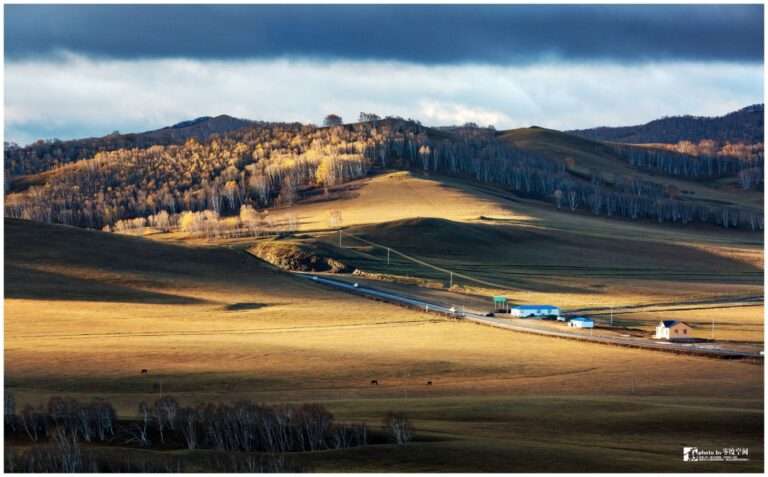
In summer and autumn, in addition to the overwhelming Hulunbuir, the Ulanbu and Gonger grasslands in Chifeng, Inner Mongolia, which are also of high appearance level, are regarded as the back garden of the Beijing-Tianjin-Hebei region due to their close proximity to Beijing.
The same as the Moga Road in Arshan, the Rea line, the Dada line and the Jingwu line, which are also known as the landscape avenue, connect the grassland and forest scenery in the Bashang area, and are the most worthy routes in Chifeng.
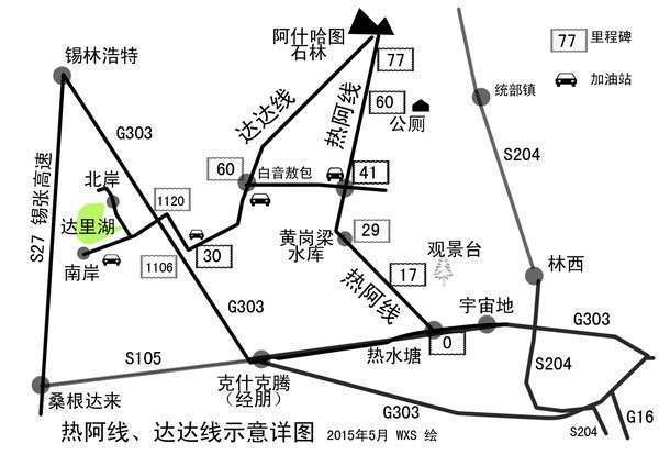
The starting point of the Dada line, Darijure Lake, known as the “paradise of 100 birds”, is a bird watching resort; Along the way is the endless Gonger grassland, straight asphalt road to the sky, ending in Askhatu stone forest is the remains of Quaternary glaciers. The adjacent Ree-A line connects Ashatu Stone Circle with Reitshuitang Town, and on the way is the forest grassland scenery of Huanggangliang Mountain area.
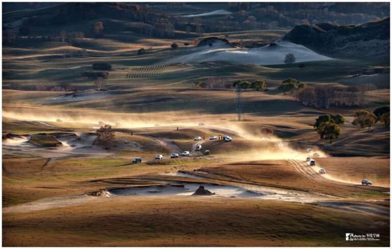
The line connecting Hexigten Banner through Peng town and Ulan Budong is also known as the “northern Xinjiang Avenue in the suburbs of Beijing”, birch forest, alpine meadow, the autumn color will be interpreted inciand vividly.
【 Reference route 】
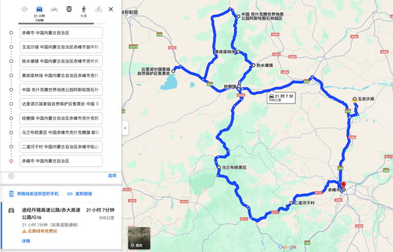
D1: Chifeng → Yulong Sand Lake → Reshui Pond Town
D2: Reshuitang Town (Rea Line) → Huanggangliang Forest Farm → Ashartu Stone Forest Scenic Area (Dada Line) → Gonger Grassland → Baiyinaobao sand spruce → Dalinore National Nature Reserve
D3: Dalinore Lake → Jingpeng Town → Ulan Butong
D4: Ulan Butong → Yudaokou → Mulan Paddock
D5: Mulan Paddock → Chifeng
Note: The best driving season for Chifeng Rea-Dada Line is summer and autumn. In summer, mountains and flowers are in full bloom, and the forest and grassland can indeed be worthy of the “northern frontier outside Beijing”. Photography enthusiasts prefer to go there in autumn, because the morning fog in autumn gives the golden earth a more fairyland atmosphere. But at this time, these landscape avenues are also facing traffic jams.
In addition to starting from Chifeng, other cities can also choose the appropriate road to connect to the Re – A line, Dada line. Beijing, in particular, has plenty to choose from.

Central and western Inner Mongolia: Populus Euphrates forest and desert
West Ejin banner Euphrates poplar forest line
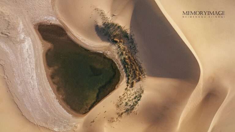
The golden autumn scenery can not be less than the poplar forest. Euphrates poplar forest in Ejin Banner is the most lively season in the western desert of Inner Mongolia every autumn. To the south of Gansu, the most classic way is to take the Hexi corridor, and then enter Ejin Banner, through Badan Jilin and Tengri Desert. The cities in this ring are almost all big cities with perfect service, so you can choose any city as a starting point for driving yourself.
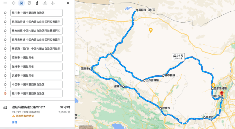
D1: Yinchuan – Alxa Left Banner Bayanhot Town, 120KM, 2 hours, stay in Bayanhot town;
D2: Bayanhot Town, Alxa Left Banner — cross the Tenggol Desert and stay in Bayanhot Town;
D3: Bayanhot Town – Badain Jarin Town, 500KM, 7 hours, stay in Badain Jarin town; Yabulai, halfway between the two towns, also serves as a rest stop;
D4: Badain Jilin Town — Badain Lake — Bilutusha Peak — Haisenchulu strange Stone City — Jinta Populus populus forest Camping Park, accommodation in Populus populus forest camping park, 300KM, about 6 hours;
D5: Jinta Populus Populus Forest Camping Park — Black City Weak water Monster Forest Scenic Spot — Dalaihubu Town, 160KM, 3 hours;
D6: Juyanhai Sunrise – Euphrates Poplar Forest Scenic spot, stay in Dalaihubu Town;
D7: Dalaihubu Town — Dongfeng Space City — Jinta Huyang Forest — Jiuquan, 400KM, about 6 hours, stay in Jiayuguan;
D8: Jiuquan – Zhangye – Wuwei, 450KM, 5.5 hours, stay in Wuwei;
D9: Wuwei — Zhongwei — Yinchuan, 500KM, 5.5 hours;
Hohhot as the center, central desert, grassland small ring line
The central and western parts of Inner Mongolia are dominated by the desert next door. The volcanic geology of Ulanqab is the star attraction in recent years, and the grassland scenery of Huanghuagou in the west. To the south is the Kubuqi Desert. With Hohhot as the center, the loop line connects all the scenic spots.
D1: Hohhot → Xilamuren Grassland → Baotou
D2: Baotou → Wuliangsuhai → Qixing Lake → Bayannur
D3: Qixing Lake → Bayannur
D4: Bayannur → Dengkou County → Wuhai
D5: Wuhai → Hangqi Town → Dongsheng District (Sand-crossing Road)
D6: Dongsheng District → Xiangsha Bay Scenic Area
D7: Xiangsha Bay → Ulanhada Volcanic Geopark
D7: Ulanhada Volcanic Geopark → Huanghuagou → Hohhot
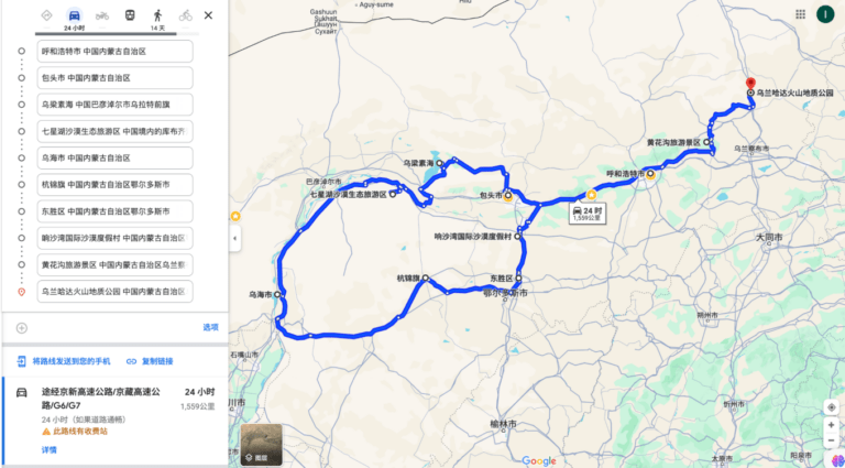
Tengger Desert + Badain Jilin Desert great Ring Road
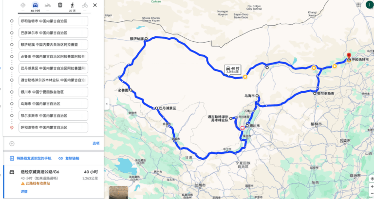
For travelers who want to experience the desert in depth, starting from Hohhot, take the Western Great Ring Road can also be realized.
D1: Hohhot → Xilamuren Grassland → Baotou
D2: Baotou → Wuliangsuhai → Qixing Lake → Bayannur
D3: Qixing Lake → Bayannur
D4: Bayannur → Ejin Banner
D5: Euphrates Euphrates Forest in Ejin Banner → Juyanhai
D6: Ejin Banner — Black City weak water monster forest → Dongfeng Euphrates poplar forest
D7: Dongfeng Euphrates Euphrates Forest Jinchuan → Bilutusha Peak → Batan Lake → Miaohaizi → Alashan Right Banner Badan Jilin Town
D8: Badain Jilin Town → Bayanhot Town
D9: Bayanhot Town → Swan Lake, Wulan Lake, Sumutu Lake, Sun Lake, Moon Lake five lakes crossing → Bayanhot town
D10: Bayanhot Town → Yinchuan
D11: Yinchuan → Wuhai
D12: Wuhai → Ordos
D13: Ordos → Hohhot
Inner Mongolia Great Ring Line: depicts the outline of Inner Mongolia
For travelers with more than a month to spend, Inner Mongolia’s eastern grasslands and forests, central Gobi cities and western deserts can be explored. In the north, there is an unimpeded border line, in the south, there is a G7 connecting the western cities of Inner Mongolia with Beijing as the center, and the Hexi Corridor and Ejin Banner meet in the westernmost section. The east has G111 series, will army Mohe. You can start from any city near you. The choice of attractions is also up to you.
The routes can be as follows: Beijing → Chifeng → Tongliao → Ulanhot → Zhalantun → Jiagedaqi → Mohe → Shiwei → Manzhouli → Arshan → Xilingol → Erlianhot → Ulanqab → Hohhot → Baotou → Bayannur → Ejin Banner → Jiuquan → Zhangye → Wuwei → Zhongwei → Yinchuan → Wuhai → Ordo → Datong → Zhangjiakou → Beijing.
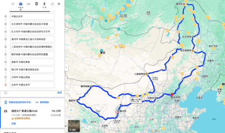
Starting from Beijing, you can also play like this
The G7 goes directly to Xinjiang through Inner Mongolia
With the opening of the expressway from Beijing to Xinjiang, it is more convenient for North China to reach central and western Inner Mongolia and even Xinjiang. It only takes us two days at the fastest to drive from the capital to Hami, the eastern city of Xinjiang, and pass through Zhangjiakou, Ulanqab, Hohhot, Baotou, Bayannur, Ejin Qi and other cities along the way. It connects the landscapes of volcanoes, grasslands, deserts and Euphrates forests in central and western Inner Mongolia. But it should be noted that if you are coming for the poplar forest, remember to choose the right season, mid-late September to early October is the best.
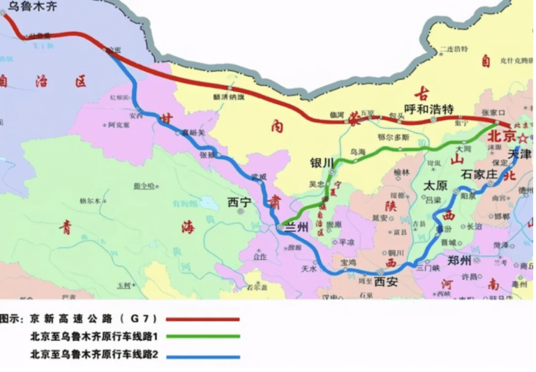
【 Line Overview 】
D1: Beijing → Zhangjiakou → Ulan Qab → Ulan Hada Volcano Address Park, 362KM, 5 hours, stay in Ulan Qab;
D2: Ulanqab → Huanghuagou → Hohhot, 200km, 3.5 hours, stay in Hohhot;
D3: Hohhot → Qixing Lake → Baotou, 186KM, 2 hours, stay in Baotou;
D4: Baotou → Bayannur, 250KM, 3 hours, stay in Bayannzhuo;
D5: Bayannur → Ejin Banner, 676KM, 8 hours, stay in Ejin Banner;
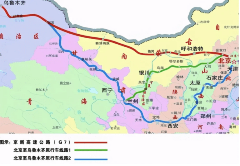

Hami can be reached along the G7 from Ejin Banner. Then start a trip to Xinjiang. Xinjiang play strategy, can be viewed:
G111 goes directly to Mohe
In 2019, the G111 line connecting Beijing directly to Mohe was opened, which also means that it is possible to drive directly from Beijing to Mohe, China’s “Arctic”. Most of the 2129 km journey is in Inner Mongolia, connecting many scenic spots in the suburbs of Beijing, such as Fengning Bashang, Saihanba, Ulan Butong, then Inner Mongolia Horqin sand grassland, and finally reaching Mohe through the Greater Khingan Mountains. Autumn is two kilometers of beautiful golden gallery, and winter, is more than 2000 kilometers of goose north fairy tale.
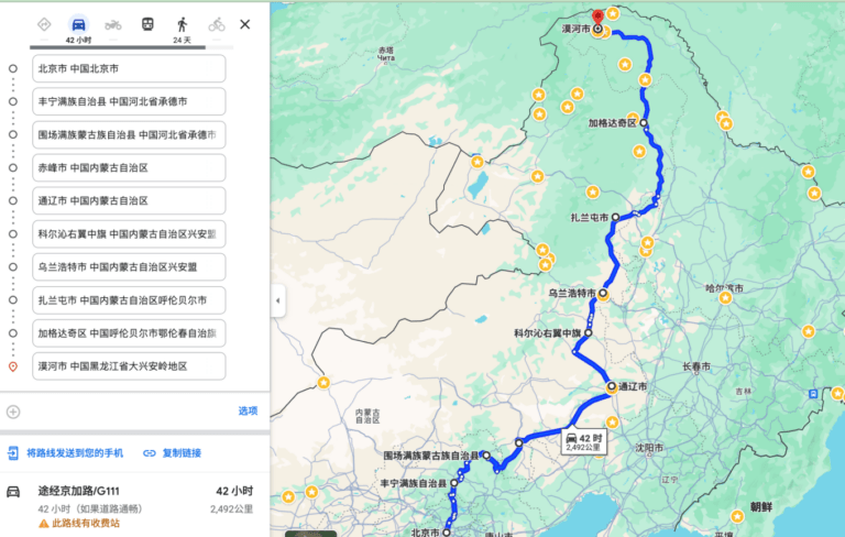
【 Line Overview 】
D1: Beijing → Fengning Bashang → Mulan Weichang, 373KM, Suweichang Town; The grassland in the suburbs of Beijing was swept away;
D2: Mulan Paddock → Chifeng → Tongliao, 500km, stay in Tongliao;
D3: Tongliao → Horqin Right Banner → Ulanhot, 349KM, stay in Ulanhot; Across the Horqin grassland;
D4: Ulanhot → Zalantun, 267KM, stay in Zalantun; From the grassland scenery to the forest scenery of the Greater Khingan Mountains;
D5: Zalantun → Jagdaqi, 390KM, stay in Jagdaqi; From then on into the Greater Hinggan Mountains scenery, directly to Mohe River.
D6: Jagdaqi → Tahe River, 327KM;
D7: Tahe → Mohe, 302KM.

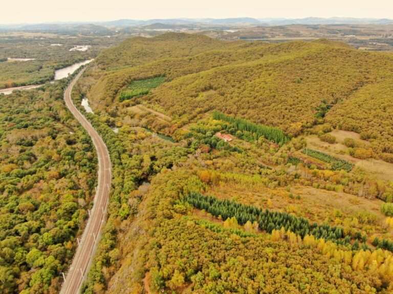
For travelers who do not want to go back, there are two options. One is to take the northern border line and return to Beijing via Hulunbuir, Manzhouli, Arshan and Xilingol in Inner Mongolia. Another plan is to take the southern route across the northeast, through the Little Khingan Mountains in Yichun, through Haier Bin, Changchun, Shenyang and back to Beijing.
